Your email will not be communicated to any third party or company outside France Bike Trips / Velorizons. You may receive occasional emails from France Bike Trips, with the possibility to unsubscribe at any time. CNIL (French National Commission for Data Protection and Liberties)
Please type in your search terms.
You can prefix chosen words with the '+' sign to make them mandatory, or with the '-' sign to avoid results containing this word from appearing, e.g. west +nepal -canada
A dedicated team of travel specialists is available to offer you expert advice Monday to Friday from 9 to 12:30 AM and 13:30 to 6 PM (French time) on the phone, or by email.
This trip is for those looking for pure cycling adventure, who like to enjoy their ride, eyes wide open. This completely new Gravel crossing starts at the foot of the famous Sierra de Guara, home to vultures, climbers and canyoneers of all kinds! The great ochre cliffs overhang impressive chasms that the Rio has shaped. On the plateau, magical gravel tracks wind between a few Picos, small pudgy peaks that sit under the eye of Monte Perdido. We pass (and spend the night!) at the foot of the famous Loarre castle, a Romanesque fortress from which the view of the Zaragoza plain stretches to infinity. With our gravel bars turned to the west, the rolling, panoramic tracks lead us to the "Mallos" of Riglos and Agüero, impressive rocky spires where countless birds of prey swirl. This gravel trip saves the best for last: Gravel grinding the moon-like desert of the Bardenas Reales, a breathtaking and vast geological curiosity. Tabular hills, fairy chimneys, dry barrancos, everything here evokes the Far West. Incredible rolling double and single tracks make their way through this dreamy setting, allowing us to explore every corner of the Bardenas, thanks to a loop and a crossing from north to south. A gravel trip of a lifetime!
Some of our Gravel tours offer various levels of difficulty, from 1 to 3. When variants are available, details (distance and altitude gain) can be viewed in the day by day details of the “programme” tab.
In the case of tours with variants, regardless of the level you choose, accommodation is always in the same destination (except some rare exceptions, clearly stated in the description). This allows you to choose the most suitable level on a day-to-day basis.
We meet in the late afternoon in Ainsa, a small Aragonese town located on the Spanish side of the border, opposite Saint Lary Soulan and Lannemezan. If you have chosen the "with assistance vehicle" tour, we will have our first dinner together, a welcome drink and a full briefing on the week ahead. If you have chosen the "self-guided" tour, it is time to check your equipment and do some additional shopping in Ainsa.
Vamos for this great gravel crossing! A nice little road takes us slowly up to the Sierra de Guara plateau, which allows us to work up an appetite. We then attack our first track (unsealed road), at the sight of which our gravels tremble with joy! Little by little, we go deeper into the heart of this wild massif and pass by some abandoned stone villages. The plateau of the Sierra de Guara is varied: alternating landscapes of moorland and coniferous forests, with the snowy peaks of the Mont Perdu massif in the background. What a scenery! Those of us who have chosen level 2 leave a little further south, to discover the Rio Vero and Balcez. After having recovered a very small road and swallowed some 150m of slightly steep difference in altitude, we reach the village of Nocito, nestled at the confluence of several valleys. Night in this heavenly place...
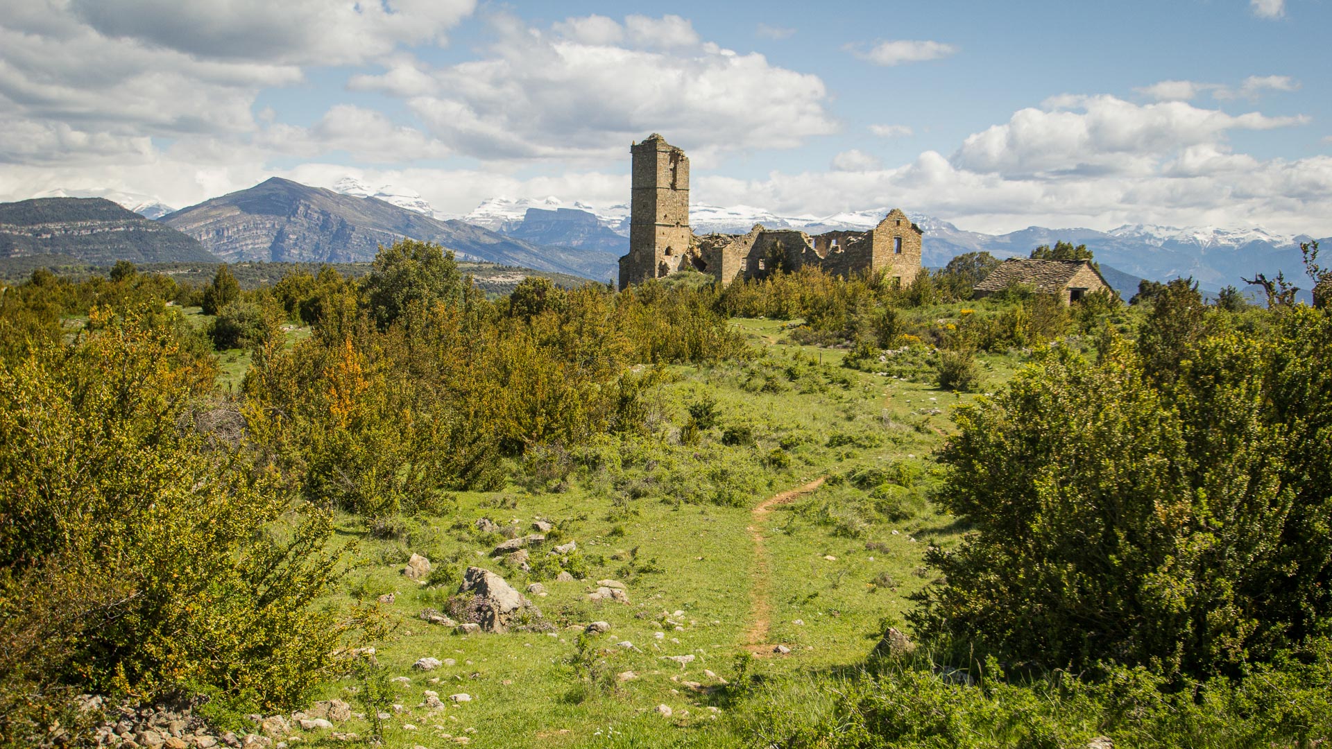
We leave our idyllic valley over a small pass that allows us to "dive" into the lake of Belsué. A very rolling descent over a Rio set in a deep canyon, before opening up into the open valley of Lake Belsué. After crossing the small village of Belsué, a superb little balcony road overlooking the Nueno valley. Level 2 literally plunges into the valley to discover the village of Boléa and its superb 16th century collegiate church, before climbing back onto the ridge. We then find a track that goes down towards the northern foothills, up to the altitude of 1460m where our final descent to Loarre and its medieval castle begins. The 13th century fortress of Loarre, the jewel of northern Aragon, dominates the entire valley. We can visit the castle at the end of the day, and settle into our accommodation further down in the village. A sweet Spanish evening with, why not, a glass of rosé or a cold beer before dinner, accompanied by some local tapas!
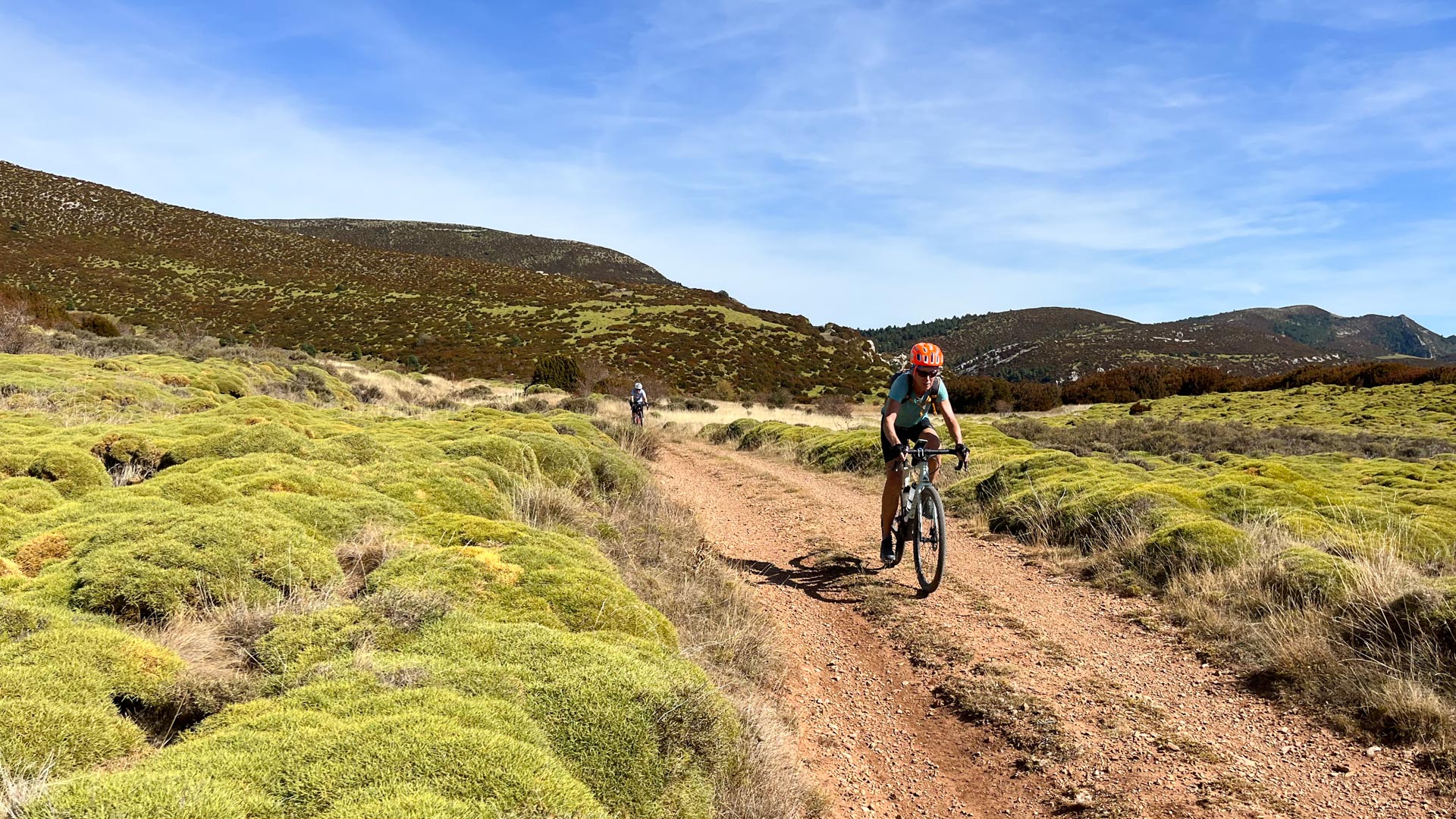
Head for the Mallos de Riglos! You probably know them, at least in photos, these great monoliths, the highest of which reaches 300m. But before admiring their slender silhouettes, we leave Loarre in an invigorating way, with a short climb of 200m and a superb panoramic track opening onto the colourful canvas of the valley's crops. A morning like we like! The Mallos, then. And here they are! As soon as we start our descent towards the Rio Gallego, their large reddish faces jump out at us. And what a sight! The griffon vultures circling above them give them a mysterious character. Those of us who have a sharp eye will perhaps see a group of experienced climbers in the middle of the route. We cross the Rio Gallego and start our ascent to the Sierra de Santo Domingo (level 2). This long ridge, reaching 1517 metres in altitude, stretches for about 50 kilometres from east to west, separating the valleys of Jaca and Zaragoza. A balcony trail allows us to walk along it, almost at the top, offering endless views of the Zaragoza plain. We descend through the Pigalo valley and its many natural pools, which invite us to take a swim (or a dip, as it will probably be a bit cool!). The level 1 route also passes through a small mountainous area before descending to Biel and discovering its fortifications. After a few last turns of the pedals, we find ourselves in Luesia, dominated by the ruins of its castle.
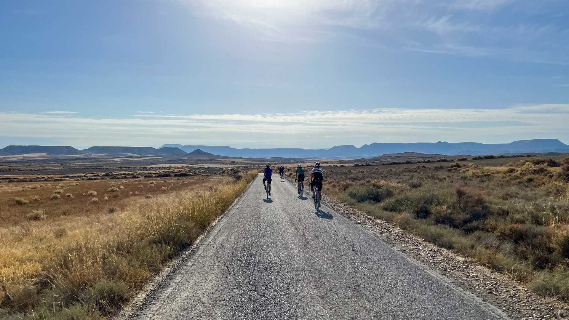
We (re)climb the slopes of the Sierra de Santo Domingo to enjoy the last views of the infinite. Countless impressive windmills spin their propellers on top of all the mountains we see in the distance. The shadow of Don Quixote fighting against the windmills still looms... We bid farewell to the Sierra de Santo Domingo as we descend to the village of Castilliscar on a rolling track. A total change of scenery: we are now in the transitional plain that separates the Sierras from the "desert" of the Bardenas. Cross the plain to reach Murillo El Fruto.
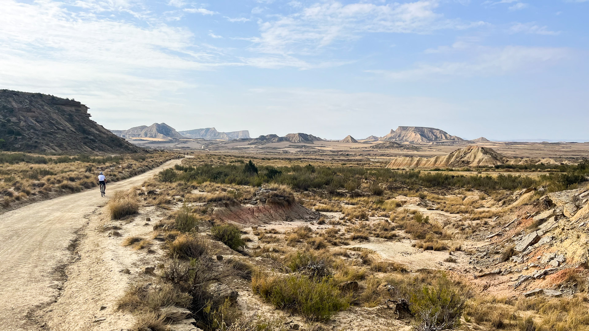
After passing through Carcastillo and its old Basque pelota court, we immerse ourselves in the atmosphere of the Bardenas with its eroded sedimentary formations and abandoned corrals. The Bardenas are one of the two main "deserts" of the Pyrenees. A "desert" without a doubt in terms of population, since there are simply 0 inhabitants per square kilometre! Less "desert" if you look at the vegetation, because even if the land is often bare, you can still find trees, bushes and even cereal crops...
The only shadow in the Bardenas is the presence of a "military polygon" located in the middle of this natural park. The only problem is the presence of a "military polygon" in the middle of the park, which means that the noise of the military planes flying over the area (irregularly and unpredictably) must be ignored. The vultures have even learned to live with it...
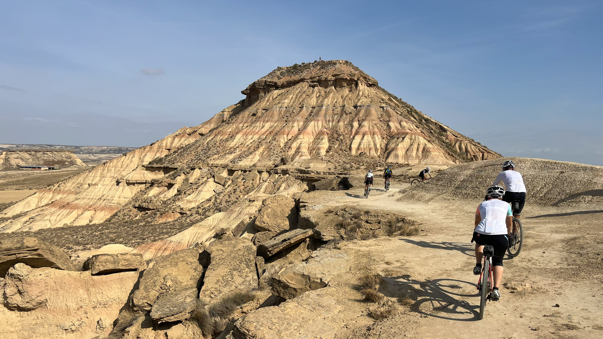
On this loop of discovery of the Bardenas, we drive through the heart of the "Bardena Blanca", one of the "must" of these western landscapes (The Bardena Blanca is also called "Badlands" because of its resemblance with the Dakota in the United States). Entering the Rallôn valley, passing at the foot of the Pisquera walls...all on tracks made for Gravel. What happiness!
An unforgettable day in the life of a Gravel enthusiast! Night at the same accommodation as the day before.
And then we are back in the wild-west scenery of the Bardenas. We pass by the famous Castillo de Penaflor and Castildetierra (the "Earth Castle" with its tower pointing to the sky). Numerous abandoned corrals bear witness to the intense pastoral life that reigned here a few decades ago... We still come across many shepherds with their flocks of sheep. As we descend southwards on superb tracks, we enjoy our last views of the magnificent Bardenas landscape. At the meeting point with the southern road, the level 1 route stops, while level 2 continues further south to discover the small natural park of Caïdas de la Negra. Once we are all together, we load the bikes on our minibus and start the transfer back to Ainsa (about 3 hours). On the way back, the landscapes go by and we are reminded of those beautiful days of Gravel!
We return to Ainsa and enjoy a nice last evening in the Spanish way, a good last dinner all together, and a last night before taking the road again tomorrow, rested.
Separation after breakfast (around 9am).
Adiós amigos, y hasta pronto!
Distances and altitude gain are an indication only and may vary.
Make sure to check our France Bike Trips media gallery in order to get a feel for this trip and this destination.
After your trip with us, you also have the opportunity to create your own album with your impressions. We would be happy to do the work for you - all you have to do is send us your photos.
Don't miss new albums in our online gallery with our email notifications! As soon as a new photo or video album is published, you will receive a short e-mail from us. To subscribe, click on "Be notified of new albums" in the media gallery.