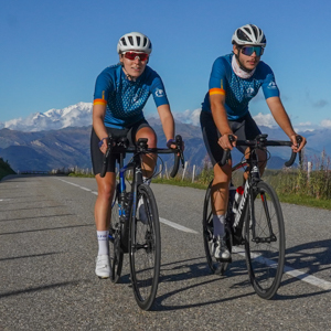
This Alpine road bike crossing is a true insider's tip. We start at the picturesque lake of Annecy in High Savoy and cross the little-known French Prealps which stretch like a string of pearls to the Côte d'Azur. Most of the mountain ranges we pass by are nature parks which protect the beauty of their landscapes and their authentic rural character. Their names may speak for themselves: Bauges, Chartreuse, Vercors, Diois, Baronnies, Monts de Vaucluse, Luberon, Verdon, Esterel. The main strength of this crossing is the peacefulness of the small mountain roads and their outstanding scenic character. A multitude of superb passes on a "human" scale with, in passing, the ascent of the mythical Mont Ventoux. Last stop: The Mediterranean Sea. Without doubt, this crossing is a must-do on your bucket list that will surprise you.
| From 26/04/2026 to 02/05/2026 | 7 days | 1325 € | Available |
| From 24/05/2026 to 30/05/2026 | 7 days | 1325 € | Confirmed shortly |
| From 14/06/2026 to 20/06/2026 | 7 days | 1325 € | Available |
| From 05/07/2026 to 11/07/2026 | 7 days | 1390 € | Available |
| From 23/08/2026 to 29/08/2026 | 7 days | 1390 € | First bookings |
| From 06/09/2026 to 12/09/2026 | 7 days | 1325 € | Confirmed |
| From 20/09/2026 to 26/09/2026 | 7 days | 1325 € | Available |
(Price per person)
| Single room accommodation (7 nights) | 280 € /  |
| Transfer Fréjus - Annecy at the end of the trip | 95 € /  |
| Transport of a rigid bike box or a semi-rigid bike bag during the trip The supplement concerns rigid bike boxes (non-collapsible) and semi-rigid bike bags (collapsible) which are larger than typical hand luggage when folded (56 cm × 45 cm × 25 cm). Ex. Evoc bike bag. Soft bike bags (bags that can be folded entirely and stored under the seats) are transported free of charge. |
40 € /  |
| Extra night in Annecy in 3* hotel, double or twin room, including breakfast | 120 € /  |
| Extra night in Annecy in 3* hotel, single room, including breakfast | 220 € /  |
| Transport of a rigid bike box or a semi-rigid bike bag during the trip The supplement concerns rigid bike boxes (non-collapsible) and semi-rigid bike bags (collapsible) which are larger than typical hand luggage when folded (56 cm × 45 cm × 25 cm). Ex. Evoc bike bag. Soft bike bags (bags that can be folded entirely and stored under the seats) are transported free of charge. |
40 € /  |
| Vélorizons cycling jersey (shipping not included) |
75 € /  |
Extra nights in Fréjus: on request
| Standard road bike Carbon frame and fork, disc brakes, Shimano Tiagra groupset, 10 speeds, 50/34 - 11/32, aluminium wheelset, model Scott Addict 50 or equivalent, roughly 9 kg |
325 € /  |
| Premium road bike Carbon frame and fork, disc brakes, Shimano 105 groupset, 12 Di2 speeds, 50/34 - 11/32, aluminium wheelset, model Scott Addict 40 or equivalent, roughly 8,9 kg |
395 € /  |
| Ultimate road bike Carbon frame and fork, disc brakes, Shimano 105 groupset, 12 Di2 speeds, 50/34 - 11/34, carbon Mavic or Syncros wheelset, model Scott Addict 30 or equivalent, roughly 8,4 kg |
510 € /  |
| E-road bike Carbon frame and fork, aluminium wheelset, Shimano 105 groupset, 11 speeds, 50/34 - 11/32 supplied with 1 x 248Wh battery (+ 1 extra battery 210Wh), model Orbea Gain M30 or equivalent, roughly 13 kg |
700 € /  |
In your booking form, please let us know the model you require, your pedal preference and your body size (including frame size and stride length if possible). Thank you very much.
You will receive your hire bike on day 1 of your tour from the tour guide (support vehicle). Bike check on handover and after the tour.
Consumables (tyres, tubes, brake pads and cables) are included in the rental price. Only parts damaged during the tour due to a fall or improper use must be replaced. In the event of theft or loss, you will be charged a lump sum (€2,200 for the standard model, €3,590 for the premium model and the e-model and €5,700 for the super light model).


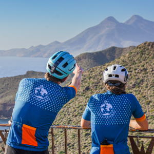
A timeless road cycling jersey produced in France, inspired by our team and our road cycling trips. High quality, made in France by a Savoy company and with a feel-good character for long days in the saddle. Offered at a great price.
- High-quality SIRTECH + LYCRA textiles
- 3 pockets, one with a central zip + 1 side pocket
- Full front zip
- Half-high cycling collar
- Short raglan sleeves in Lycra with seamless ends
- Gripper at the hem
Available sizes (EU sizing): XXS bis XL
Cut: Slim fit, unisex
Price: see above
Order and further information by e-Mail or ask our leaders while on tour.
You are a group of friends, a family, a company or a cycling club and you would like to organise a private cycling tour on the dates of your choice. This option is available for guided and self-guided tours.
For more information or to receive a quote, please contact us by phone at +33 458 140 435 or by email at info@france-bike-trips.com.
It is important to be correctly insured when embarking on a cycling holiday. We recommend checking the details of your travel insurance (if you have one) and, if necessary, subscribing to our contract below. Please note that France Bike Trips is simply an intermediary between you and the insurance company.
You can choose between these travel insurance contracts while completing your booking form:
Recommendation: |
In order to make a booking please fill in the online booking form on the "booking" page of your chosen tour. At the end of the booking process you will be transferred to our bank's secure payment page in order to pay a 30 % deposit.
All self-guided bookings made within 21 days of tour departure will incur a surcharge of 15 € per person.
A dedicated team of travel specialists is available to offer you expert advice Monday to Friday from 9 am to 6 pm (French time) by phone - +33 458 140 435 or by mail - info@france-bike-trips.com.
In order to confirm our guided tours, we need to reach a minimum number of participants (usually 5 persons are necessary). Therefore booking a guided tour does not necessarily mean the tour is confirmed. In the unlikely event that we are unable to confirm your chosen tour, we will offer you the opportunity (no less than 21 days before departure) of switching to another (confirmed) tour, or receiving a full refund.
Self-guided or custom tours: We confirm bookings of self-guided tours and custom tours directly after booking.
In both cases, please await our final booking confirmation before making any travel arrangements.
Tour balance payment must be made no less than 30 days before tour departure. Your travel documents will be sent to you once we have received your balance payment. Road books and maps will be sent to you 3 weeks before departure.
In the event that you are obliged to cancel your tour France Bike Trips will reimburse the entire sum paid for the tour, minus the following cancellation charges:
Full details of our sales conditions are available here
During riding you carry only your day pack. All your luggage is transported each day by the support vehicle.
After breakfast, the support vehicle driver will pack your luggage in the van, distribute cereal/energy bars, and announce the time slot for lunch. The driver can also hand out picnics to any participants who do not wish to stop at the designated picnic lunch stop.
Once all the participants have passed the picnic stop, the driver transports your luggage directly to the following nights accommodation, before returning to wait at the foot of the last climb of the day. He is then available to help any members of the group in difficulty or who encounter a mechanical problem. You'll usually meet the van driver several times during the day, offering the opportunity to fill up with water, change clothing, etc.
Each participant is free to ride at his or her own pace, using the road book and GPS route to navigate during the day. However, the driver is equipped with a mobile phone, and can be reached at any time during the day if a particpant encounters a problem. The driver is also available throughout the trip to provide information and advice.
By train: From Paris Gare de Lyon train station to Annecy train station (about 3h by TGV train).
https://www.sncf-connect.com/en-en/
By plane:
By car:
Route planner: en.mappy.com
Coming back:
You can return to Annecy by taking the train from Fréjus (about 8h) : https://www.sncf-connect.com/en-en/
You will receive an email 2 weeks before departure, containing all the information necessary for your upcoming tour, including the following navigation tools:

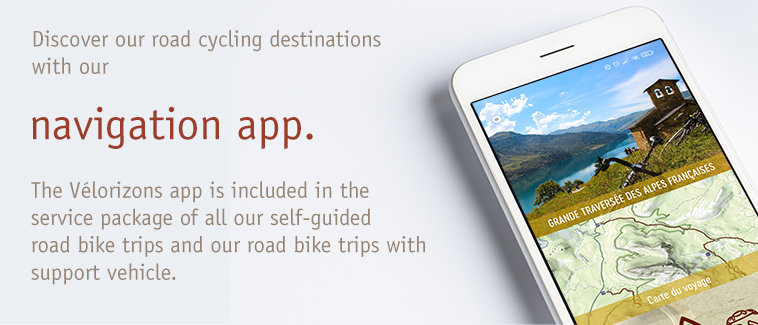
Follow your route with comfort and ease! Thanks to the Velorizons navigation app, download the full trip itinerary to your smartphone, view route maps and profiles, access the list of booked accommodation, services and useful contacts, and use the integrated route guidance (visual and vocal) for navigation.
►See the mobile app presentation video
To benefit fully from the app navigation system, we strongly recommend attaching your smartphone to the bicycle handlebar using a dedicated mount. An example can be viewed here.
| Operating system | Android | Apple | Windows Phone | Blackberry |
| Compatibility | Version 8.0 minimum | iOS 8.0 minimum. iPhone compatible, iPad compatible if GPS equipped | Non compatible | Non compatible |
Your tour road book will be available to download in your My France Bike Trips customer area. The road book contains:
Tour GPS tracks will be available to download in your My France Bike Trips customer area. The tracks are in .gpx format, compatible with all GPS devices/apps.
We favour comfortable accommodation with warm hospitality.
Our standard price is based on 2* and 3* hotels and comfortable guesthouses with double rooms and en-suite facilities.
For private groups and self-guided trips it is possible to customise the accommodation (upgrade) depending on availability.
This trip is fully catered (breakfast, lunch and dinner included). We pay very careful attention to the quality and the variety of your meals. Fresh and local products will be served wherever possible. This trip is also an opportunity to discover the local gastronomy and regional products - l'art de la table!
Please note: If you have any food intolerances, please inform us in the comments field on the booking form.
For lunch, our tour leader will offer you a picnic stop along the route. Our picnics combine a rich salad based on carbohydrates and fresh vegetables with cold meats and cheese, fresh fruit and bread (wherever possible from local producers) as well as sweet and savoury snacks. If you do not want to stop for lunch, we can offer the following options:
If you sign up for a guided tour, we offer you the opportunity to see if you can carpool with other participants to get to the point of departure. To do this, go to "Car sharing" in our website. By entering the complete reference and the date of departure of the tour (available on the registration confirmation that we have sent you), you have access to route details and emails of other participants who wish to carpool.
During the day you carry only a daypack for additional clothing, water, food, camera, etc. The rest of your baggage is transferred each day to the following nights accommodation.
- A "group" tour: If you join a guided tour, you will be part of a group for several days. This is a superb opportunity to meet new people and share some magical moments. However, a group tour requires that each person show friendliness, openness and mutual respect for their fellow travellers.
- An "adventure" tour: despite the most careful preparation, adventure tours can present unforeseen events. Accepting these risks will help you enjoy your trip to the full, in the knowledge that your guide, our local partners and the entire France Bike Trips team will offer you the most suitable solutions to any given situation.
If you decide to bring your own bike, be aware that transporting a bike by plane or train is no longer an issue. However a few simple guidelines help to optimise the transport and avoid potential damages that could occur.
Your bike must be transported in a designated bike bag (standard size 120x90cm). This maximal size allows you to travel with your bike as "hand luggage" in any high-speed and regional trains.
It is very important that you protect your bike in the bag. After having deflated the tires, removed the wheels (by removing the quick release mechanisms), pedals and rear derailleur (which is left hanging on the chain), we recommend you wrap your bike inside the bag in a sheet of dense foam (thickness of 3 to 5 cm). A piece of cardboard or rigid plastic positioned between the foam and the inside of the cover can be beneficial to provide more rigidity.
Once folded up the bike bag will take up very little space and will be transported by the assistance vehicle during your tour.
Bike bags are available directly from France Bike Trips at a cost of 70 euros, plus postage.
All your belongings should be divided into two bags: a backpack and a travel bag.
This is the bag you use every day while cycling. It is kept in the support vehicle (accessible during the lunch stop or carried along on the bike (frame, seat or handlebar bag). This bag should not be too large (up to 15 litres).
It will contain: snack food, camera, waterproof and extra clothing, sunglasses, etc.
This bag will be transported by vehicle from one accommodation to the next. It should contain all the items you won’t need during the day. You can expect to find it at your accommodation in the evening (generally not accessible during lunch).
Average tour rating:
Please type in your search terms.
You can prefix chosen words with the '+' sign to make them mandatory, or with the '-' sign to avoid results containing this word from appearing, e.g. west +nepal -canada
A dedicated team of travel specialists is available to offer you expert advice Monday to Friday from 9 to 12:30 AM and 13:30 to 6 PM (French time) on the phone, or by email.
Your email will not be communicated to any third party or company outside France Bike Trips / Velorizons. You may receive occasional emails from France Bike Trips, with the possibility to unsubscribe at any time. CNIL (French National Commission for Data Protection and Liberties)